I spent the morning yesterday with Josh MacFadyen at his lab at UPEI. We ranged over a lot of topics, but I was really intrigued by his copy of a version of Samuel Holland’s 1765 map of the Island of St John [Isle St-Jean/Prince Edward Island]. It’s an amazing map in many ways, and Max Edelson’s marvellous The New Map of Empire (Harvard UP, 2017) tells the story of its creation well. But there are apparently different versions of the map and Josh has a superb digitisation of one I’d never seen before – said to be “the original” – which notes actual buildings in settlements across the island. Students in my 2020 colonial North America course mapped Acadian families who were expelled after the British conquest of 1758. They offered a powerful sense of the losses many families incurred in Isle St-Jean’s part of le Grand Dérangement. What I want to sketch here is how we could recreate some of these sites, allowing us to see, among many things, productive farm data across almost 300 years.
Here’s a detail from sheet 10 of the Holland map. It’s from what is today the head of the Hillsborough River. The small red squares (and one mysterious red circle – it’s on a brook, perhaps a mill?) appear to mark farm sites, though it’s not clear exactly what they are – buildings? houses? farms? Elsewhere we can also see other indicators such as churches (a cross) and mills (a windmill-like shape).

Twelve years later, DesBarres’s Atlantic Neptune shows farms and cleared lands along the same bends (red arrows). To the southwest, (blue arrow) other farms where Acadian farms were indicated in 1730.

We can examine this location on other maps. Here I’ll use the portage to Tracadie as a reference. At that point, the river turns east and then splits at about Pisquid. [the 1730 French map says this portage is to Havre St-Pierre, but that’s surely an error – a portage to Havre St. Pierre would not start when the river is still running north, it would need to run ENE [this seems NNW], and would be much longer – about 5 km – than suggested here].
That location seems to match this cluster of farms noted on this unauthored French map from 1730: Plan de la rivière du Nord Est (Bibliothèque nationale de France – here). This detail shows only a small corner of the map, but we can see a cluster of individual farm sites, identified with what appears to be an extended family named Martin, noted along the southern shore of the river.

Though this map is from 1730, thirty-five years before Holland, we can locate some of these people in the 1752 census of Isle St-Jean. Here’s Joseph Martin, on rivière du Nord Est, as noted by Sieur de La Roque in 1752:

Joseph Martin was 50 years of age, having arrived from Acadie thirty years earlier [ca.1722]. The 1730 map shows a group of Martin households .We can presume Joseph was 20 when they arrived, and granted this land. It’s possible that he was the son or nephew of the Paul, Charles, Pierre, or Joseph indicated, but given the ages and dates this is probably the same man.. Thus we get a quick picture of a family, a farm and its stock on a farmed site under continuous occupation since at least 1730.
Again using the portage as a reference, we can locate those farms roughly here, where the Hillsborough River forks just below Mt Stewart.

It’s worth noting that these sons of ploughmen from Acadie chose marshy tidal sites along the river, prime sites for dyking and creating grasslands – the kind of site Acadian farmers knew well.

Indeed, google maps shows some of that land to be a lagoon/barrachois.

Though satellite imagery shows that piece to be dyked. It doesn’t appear productive – i.e, it’s not being farmed – but it’s not a marsh like the land to north.

And that particular site appears to have drained and flooded and other occasions. This 1968 aerial shot shows the site as a marsh again [orientation is north roughly to the right]. (PEI, aerial photo reference 1085-95)

Can we see more, or back further in time? There’s little evidence of the Mi’kmaq on Holland’s map. Holland renamed most of Isle St-Jean [though occasionally noting “Called by the French …”]. Some of the French maps included significant amounts of Mi’kmaw data – more so in Isle Royale than Isle St-Jean – but almost none of that is evident in what Holland produced in 1765, or on the 1730 French map. Other French maps prior to 1758 show Indigenous names only along the north shore [Quiquibougouat/New London Bay, and Cascamquesques/Cascumpec Bay], areas still commonly associated with Mi’kmaw sites. While the accuracy and beauty of the map is extraordinary, it was very much a tool of empire: establishing certainty on land and possibilities for settlement and government, and representing this newly-captured island clearly as a British place. But there is one very interesting possibility. In the little corner I examine above, across the river from those farm sites, is the Scotchfort Mi’kmaw [Abegweit First Nation]. I don’t anything about this history of this reserve, but if it was based on a then-known Mi’kmaw site then there’s still more human history to be explored on that bend in the river.

This is very much me a dabbler in mapping, and Josh and his lab folks no doubt saw these possibilities long ago. But I was really fired by the possibility of what I saw in Josh’s lab: of bringing a longer view of history to such sites. For the past few years I’ve been teaching using projects based on that period around the Seven Years War and I’m really excited to see some new possibilities for extending those projects into new directions.
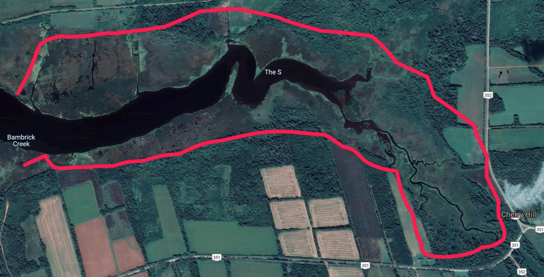
POSTSCRIPT (February 2022): I now think I positioned the Martin cluster too far south/west – they were, I now think, about 2 km further up the river, in this marshy area just west of what is today Cherry Hill. My Evernote file on Lot 29 explains.